
News
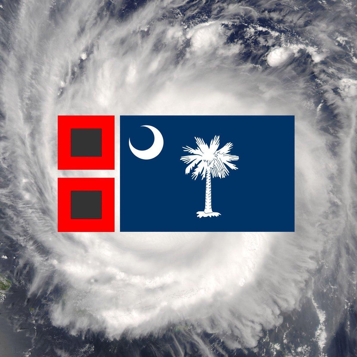
The Latest on Hurricane Matthew – Friday Edition
 Last updated on 10/7/16 at 10:57 pm.
Tip – consider taking screenshots of important information so you can access to it if you lose power.
Although I will do my best to pass along relevant and accurate information, be sure to follow local/national media and local government too. They are professionals and will have the best possible information.
WARNINGS/WATCHES
- Beaufort, Berkeley, Charleston, Colleton, Dorchester, Hampton, and Jasper counties are under a Tornado Watch until midnight
- Entire SC Coast is under a Hurricane Warning
- Berkeley, Charleston, and Dorchester Counties are under a Flash Flood Warning until 1:45 am
- Beaufort and Jasper Counties are under a Flash Flood Warning until 5:45 am
- Tropical Storm Warning: Williamsburg County
THE LATEST INFORMATION
- The most up-to-date storm tracker from the National Hurricane Center can be found here.
- Matthew is currently a Category 2 Hurricane
- It’s expected to be a Category 1 or 2 when it reaches South Carolina
- Wind: Tropical storm force likely, but hurricane force gusts possible
- Expected rainfall: 8-14″
- Possible Storm Surge: 4-8′ above ground
- Biggest impact is expected to be from Friday PM until Saturday AM
- The latest estimates have the hurricane’s eye passing just off the coast of Charleston at 8 am on Saturday
- SCEMD: “Life threatening storm surge (over 8 feet) expected on SC coast.”
- ABC News 4’s Erin Kienzle: “Hurricane force winds could spread as far inland as Dorchester County”
- Matthew is currently a Category 2 Hurricane
- Click here for open Shelter locations and addresses.
- Click here for updates from South Carolina Emergency Management Division.
- Get critical info from SCEMD via Twitter alerts – click here for more details
- Click here for updates from Charleston County Government.
- Tune to the following radio stations for messages from the Emergency Alert System:
- WIWF- Nash FM 96.9
- WEZL – 103.5
- WSCI – 89.3
- WXST- Star 99.7
- WAVF- Chuck 101.7
- WMXF- Mix 95.9
- WCKN- Kickin’ 92.5
IMPORTANT PHONE NUMBERS
- Call 9-1-1 for real emergencies only
- South Carolina Emergency Management Division: 1-866-246-0133
- S.C. Department of Transportation: 1-888-877-9151
- Charleston City Police Non-Emergency Line: 843-577-7434
- Charleston County Citizen’s Information Hotline: 843-746-3900
- Charleston County Emergency Management Department: 843-746-3800
- Charleston County Special Medical Needs: 843-953-0077
- Charleston Water System: 843-727-6800
- Berkeley County Emergency Preparedness Department: 843-719-4800, 843-719-4166, or 843-719-4047
- Berkeley County Water and Sanitation: 843-572-4400
- Dorchester County Citizen’s Information Hotline: 843-832-0393
- Dorchester County Emergency Services Department: 843-832-0341
- Dorchester County Water and Sewer Department: 843-832-0075 or 843-563-0075
- Mt. Pleasant Non-Emergency Police Line: 843-743-7200
- Santee Cooper (to report a power outage): 1-888-769-7688
- SCE&G (for power outages and downed/damaged power lines): 1-888-333-4465
- SCE&G (for gas leaks): 1-800-815-0083
CURFEWS
- Beaufort County: 7 pm to 7 am
- Berkeley County: Midnight to 6 am
- Charleston: Midnight to 6 am
- Colleton County: 11 pm to 7 am
- Dorchester County: Starts at 6 pm. Ends when “all clear” is given
- Mount Pleasant: Midnight – 6 am
- North Charleston: Midnight – 6 am
- James Island: Midnight – 6 am
- Summerville: Starts at 6 pm. Ends when “all clear” is given
- Williamsburg County: from 8 pm – 8 am
TIPS FOR YOUR HOME
- Close storm shutters, and stay away from windows. Flying glass from broken windows could injure you.
- Turn your refrigerator or freezer to the coldest setting and open only when necessary. If you lose power, food will last longer. Keep a thermometer in the refrigerator to be able to check the food temperature when the power is restored.
- Turn on your TV/radio, or check your city/county website every 30 minutes in order to get the latest weather updates and emergency instructions.
SHELTERS
- Click here for Open Shelter locations and addresses
- Items to bring if you are relocating to a shelter:
- Prescription and emergency medications, extra clothing, pillows, blankets, hygiene supplies, important documents and other comfort items.
- It’s also important not to forget special items for children, such as diapers, formula and toys, and other items for family members who have unique needs
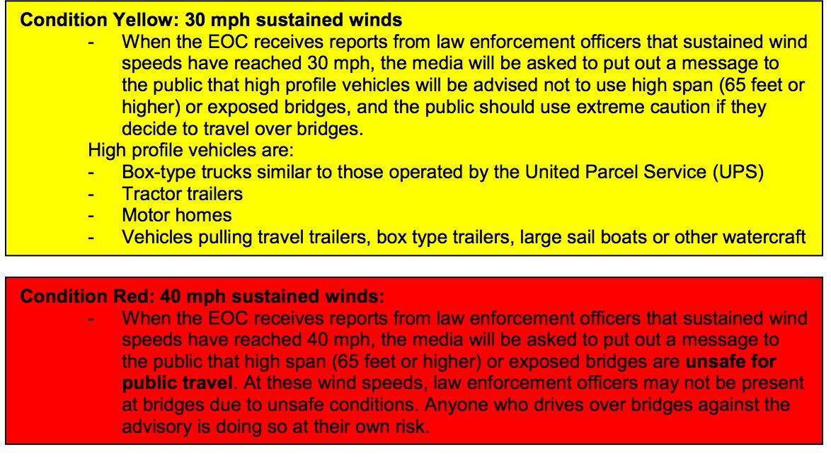
BRIDGES
- Authorities: Bridges will not be closed, but when winds become unsafe for travel, the bridges will no longer be patrolled and you will be crossing at your own risk.
- The Mount Pleasant Police Department provided this info on Bridge Procedures in High Winds:
PARKING GARAGES
- All City of Charleston parking garage locations will be open to the public to park their cars through the storm for free.
- Gates are open through 8 am on Monday, October 10th.
- These facilities will not be staffed during the storm.
- Elevators will not be operational.
- Do not park on the ground level or the top deck.


Events2 years ago
Miracle Holiday Pop-Up Bar Returns to Handcraft Kitchen & Cocktails This Month

Events2 years ago
Big Brothers Big Sisters hosts BIG Lowcountry Boil

Events2 years ago
Comedy Legend Katt Williams Returns to the North Charleston Coliseum in March

Events2 years ago
Parade, Vendor Applications Open for Upcoming ‘Holiday Magic’ Events

Events2 years ago
“Know Whatcha’ Know” Release Party & Fashion Show Set for Saturday

Events2 years ago